
Introduction to the Map of New South Wales
This detailed map of New South Wales gives travellers a clear view of Australia’s most diverse and dynamic state. It outlines the key cities, towns, and regions that make up NSW, from the bustling capital of Sydney on the Pacific Coast to the rural hubs of Dubbo, Wagga Wagga, and Broken Hill in the west. The map highlights political boundaries with neighbouring states—Queensland to the north, Victoria to the south, South Australia to the west—and also shows the surrounding waters of the Pacific Ocean and Tasman Sea.
For visitors, the map is an essential tool to understand the geography of New South Wales. You’ll find major highways and towns that connect the coast to the outback, making it easier to plan scenic road trips, coastal adventures, and countryside getaways. It also shows natural landmarks such as the Blue Mountains, coastal towns like Byron Bay, Port Macquarie, and Coffs Harbour, and the gateway points to the Australian Capital Territory and Jervis Bay Territory.
Whether you are exploring cosmopolitan cities, wine regions, heritage towns, or remote outback communities, this map provides a big-picture perspective. It helps travellers visualise distances, locate must-visit destinations, and discover hidden gems across the state. With so much to see and do, the map of New South Wales is your starting point for creating unforgettable journeys.
[caption id="attachment_48338" align="alignnone" width="1600"]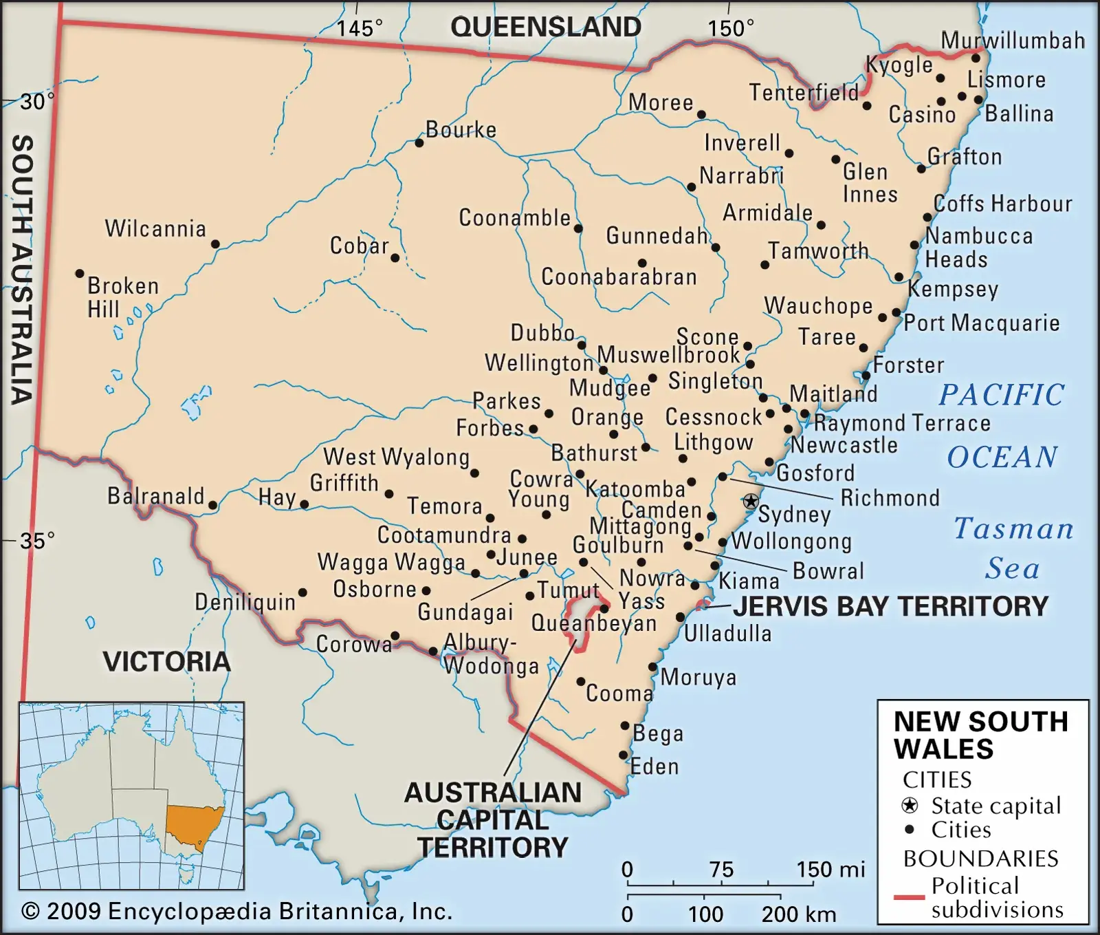 Map Of New South Wales[/caption]